
60 Hectares of Forest Destroyed in Shikahogh Reserve, While Damage Assessment Has Been Delayed: What Is Hidden Behind the Justification of Delimitation?
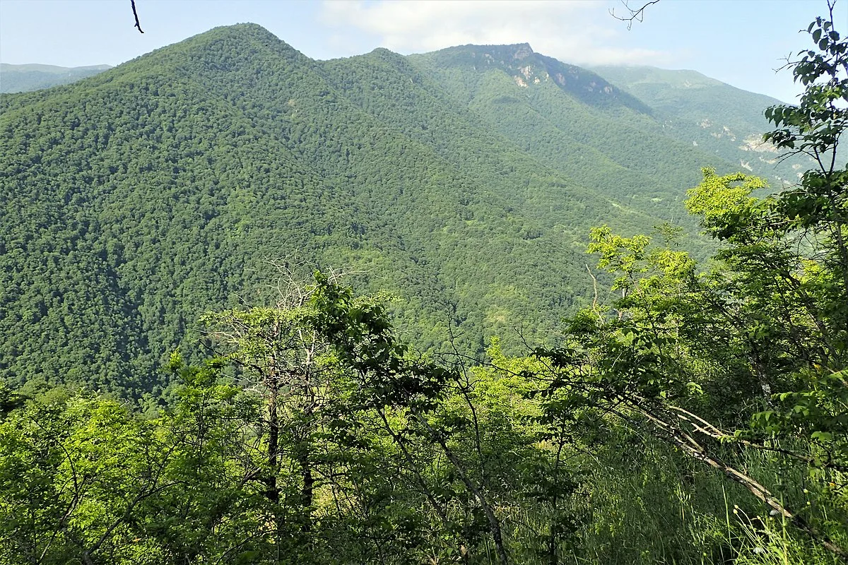
Satellite images published by Hetq in 2025 show the scale of the damage inflicted on the Shikahogh State Reserve. However, state bodies have still not presented a complete assessment, a clear action plan, or timelines. Moreover, in June 2026, Environment Minister Hambardzum Matevosyan announced that an in-depth study of the damage inflicted on the reserve had been postponed because of delimitation work with Azerbaijan. Meanwhile, when Armenia’s environment minister calls on the international community in Yerevan to turn promises to protect nature into practical results, the same standards are still not evident when it comes to the reserve in his own country.
What had Hetq uncovered?
On May 15, 2025, Hetq published an investigation according to which approximately 60 hectares of forest had been destroyed in the territory of the Shikahogh State Reserve in Syunik Province as a result of the reinforcement of Azerbaijani positions and the construction of roads. Based on satellite images and assessments by forestry specialists, it was calculated that earthworks had covered an area of around 90 hectares, of which approximately 60 hectares had been forested. According to forester Aysser Ghazaryan’s assessment, at least 14,000–16,000 cubic meters of timber had been cut down.
The Planet and Google Earth images presented in the investigation show several directions of deforestation. The roads are, on average, 7–8 meters wide, but the tree cutting was not limited to the narrow strips necessary for their construction: the adjacent stands of trees were also thinned along the roads. Oak and hornbeam forests, as well as shrubland areas, were affected the most.
According to Hetq’s investigation, the changes associated with the Azerbaijani incursion became most evident starting in 2023. Satellite images from that year show new roads and clearings in the southeastern part of the reserve. One of the roads runs through the forest as far as the lower areas of Nerkin Hand. In the 2022 images, these areas were still forested.
Therefore, this is not merely a matter of individual trees being cut down in a border area. The natural landscape of the protected area has changed, forest and shrubland communities have been damaged, and the opening of roads may place additional pressure on animal habitats.
A reserve of more than 12,000 hectares, with no complete assessment of the damage
The Shikahogh State Reserve covers an area of 12,371.1 hectares. It was established by Decision No. 341 of the Council of Ministers of the Armenian SSR, dated September 13, 1958. The reserve is located on the southeastern slopes of Mount Khustup and the northeastern slopes of the Meghri Range, in the upper basins of the Tsav and Shikahogh rivers.
Approximately 94 percent of the area is forested. Oak, hornbeam, beech, common yew, and plane trees grow there. Its flora includes around 1,100 species of higher plants, 70 of which are listed in Armenia’s Red Book. The reserve is also home to the Caucasian leopard, bezoar goat, brown bear, and other rare animal species.
Under the reserve’s charter, the construction of roads, pipelines, power transmission lines, and other communication infrastructure is prohibited. This restriction is not accidental: the purpose of the reserve is to ensure the natural development of ecosystems and preserve biodiversity and the habitats of rare species.
Under these circumstances, the felling of around 60 hectares of forest requires a clear accounting: what has been destroyed, in which areas, what are the environmental consequences of the damage, and what can be restored? Yet even after Hetq’s investigation, the public responses from state bodies have not provided a complete picture of these issues.
The ministry has been unable to provide the exact extent of the tree cutting
In 2025, Hetq contacted Arman Mkrtchyan, director of the “Zangezur Biosphere Complex” SNCO. He refused to speak, explaining that, under the procedure, permission from the ministry was required.
The written inquiry addressed to the Ministry of Environment received a response from Secretary General Sergo Atanesyan. He stated that certain sections of the reserve were under direct enemy fire, making it impossible to provide precise quantitative data on the tree cutting carried out there. Atanesyan also noted that additional communication with other relevant government agencies was necessary to properly address the issues raised.
In response to questions about contacting international environmental organizations, their reactions, and the measures being taken to prevent further tree cutting, the ministry provided general statements about international agreements and long-term measures being implemented with environmental organizations. The response did not name specific organizations, provide the dates of any submissions, or identify the results of measures taken.
The inquiry addressed to Prime Minister Nikol Pashinyan also failed to produce clear answers concerning the reserve. The Prime Minister’s Office forwarded the letter to the office of Deputy Prime Minister Mher Grigoryan. Edgar Mkrtchyan, head of that office, stated that, following the meeting of January 16, 2025, the delimitation commissions of Armenia and Azerbaijan had agreed to begin comprehensive delimitation work from the point where the borders of Armenia, Azerbaijan, and Georgia meet, moving southward.
He also stated that, at that time, no delimitation work was being carried out along the state border between Armenia and Azerbaijan in Syunik Province. However, the response did not clarify whether the issue of deforestation in the Shikahogh Reserve had been discussed, what had been done to assess the damage, or whether any demands had been presented to the Azerbaijani side.
Hetq also sent inquiries on the subject to UN Secretary-General António Guterres and Simon Stiell, Executive Secretary of the United Nations Framework Convention on Climate Change.
In June 2026, the minister announced that the study had been postponed
On June 12, 2026, Environment Minister Hambardzum Matevosyan addressed the damage inflicted on the Shikahogh Reserve while answering journalists’ questions. According to him, ecosystems in border areas had been disrupted in 2021, and attempts had been made to study the damage from both sides. However, the current circumstances did not allow a more in-depth study to be carried out.
“At this point, the damage is not measurable for us,” the minister said, adding that the issue had been postponed because of the delimitation work. He also noted that, after delimitation, it would be possible to study the damage in the border area more thoroughly and propose environmental and ecosystem restoration programs to the neighboring country.
Matevosyan’s statement essentially confirms that the problem remains unresolved. But the minister’s explanation raises new questions. If conducting an on-site study is dangerous, why is it impossible to continue the preliminary assessment of the damage using satellite images, remote monitoring, and the comparison of data already collected? If such work has been carried out, why have its results not been published?
Satellite images cannot fully replace environmental research conducted on-site. They cannot precisely determine the loss of every tree species, assess soil conditions, or fully measure the impact on wildlife. However, they make it possible to map changes in forest cover, compare images from different years, and develop a preliminary assessment of the damage.
Therefore, safety restrictions on on-site work may explain the difficulty of conducting a complete study, but they do not, in themselves, explain why the available data, the assessment methodology, or the timeline for further work are not being presented to the public.
Expectations from COP17 and the actual situation in Shikahogh
From October 19 to 30, 2026, the 17th Conference of the Parties to the UN Convention on Biological Diversity, COP17, is being held in Yerevan. The conference aims to discuss global progress in biodiversity conservation and the actions planned through 2030.
On October 12, Irina Yolyan, a member of parliament from the Strong Armenia faction, drew attention to the situation in Shikahogh during a session of the National Assembly. She asked whether the felling of around 60 hectares of forest in the territory of the Shikahogh Reserve would be raised during COP17.
The issue has broader significance than criticism from the political opposition. Armenia is hosting an international conference whose agenda includes preventing biodiversity loss, while a complete assessment of the damage recorded in the border area of its own state reserve has not been carried out for years.
Who is responsible, and what needs to be done?
Around 60 hectares of forest have been cut down in the Shikahogh Reserve. Hetq has published satellite images and an expert assessment of the damage, while the authorities have still been unable to present their own calculations and a clear action plan to the public. When asked what has been done, whom they have contacted, and how they intend to restore the damaged ecosystem, the government hides behind security restrictions and delimitation.
It is noteworthy that, in June 2026, Environment Minister Hambardzum Matevosyan linked the in-depth study to the completion of delimitation, without specifying a clear timeline. In other words, the public is not being told what has already been studied, what can be assessed using satellite data, or why at least a preliminary official picture has not been published. And in October, in Yerevan, the same government speaks on the international stage about biodiversity conservation and turning environmental commitments into practical results. Preaching nature protection from an international podium is easy; assessing the loss of a forest in one’s own country is difficult.
The destruction of Shikahogh’s forests is not merely an environmental issue. It concerns the protection of state territory, border security, and government accountability. And if the government still cannot fully assess the damage, it is obliged, to the extent possible, to document the loss, preserve the evidence, try to prevent further damage, and determine how to restore the disrupted ecosystem.